Mapping of Tree Species
Nationwide Mapping of tree species diversity in the United States
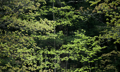 Understanding the planet's biodiversity constitutes one of the greatest scientific challenges of the new millennium(Gaston 2000, Wilson 2000). Amongst the substantial deficiency in our knowledge on almost all the aspects of biodiversity(Wilson 2000), estimating species diversity across the United States, critical for orchestrating conservation, has become a mission of growing urgency(IPBES 2017). Our mapping of tree species diversity encompasses the sciences of systematics, ecology, evolution, and geography(Sugden and Pennisi 2000) to describe the diversity, identity, and geographic distribution of tree species across the nation, and provides critical information to conservation(Wilson et al. 2006), bioprospecting(Wilson 2000), and our exploration of the little-known planet Earth(Wilson 2000).
We will further address the heretofore-ignored implications of the productivity-biodiversity relationship in natural resource management and develop a stand biodiversity capacity (SBC) framework as a novel and practical tool set to facilitate the integration of biological conservation in forestry practices. SBC is defined as a spatially explicit index to represent the amount of tree species that a forest stand is capable of sustaining. To demonstrate the generality of the SBC framework, we will apply this approach to 16 forest types in the United States. Digital maps were created for the contiguous U.S. states, southern Alaska, and the U.S. territories in the Pacific, displaying current biodiversity stocking and SBC. We will also develop SBC stocking charts for determining the optimal tree species diversity on a local forest stand, given its forest type, basal area, and site productivity. These SBC tools would be useful in integrating conservation efforts into forest management practices to various forest types on a broader scale.
Project Director: Dr. Jingjing Liang
10/17/2018 - 09/30/2023
Learn More About Us
The Purdue Student Chapter of The Wildlife Society welcomed fellow students from across the...

The Farmers Helping Hellbenders program is accepting applications through May 10 for the second...
Lieutenant Colonel Christopher Ardohain is not your average Purdue graduate student....

Brian MacGowan, Purdue extension wildlife specialist, has been honored with the Hoosier Wildlife...
The upcoming solar eclipse on April 8 has drawn the attention of scientists and the general...
Vince Milnes grew up spending time on the family farm in Brown County, Indiana, owned by his...